How to independently find water on the plot Useful advice,Plot.
Without water, you can not do without water. Water will also be needed at the stage of adjustment of the site, and when the content of the garden, not to mention the construction of the house. After all, to build a foundation will need a lot of water, and bring it from somewhere the task is not impact. So, without a source of water in the site can not do. To build a well or dried the well need to decide on the place for hydraulic equipment. However, not in any place like the place will be rationally located the water source. Of course, water can be found almost everywhere, but to act blindly will be more expensive. A man invented a lot of ways to determine the place of passage of aquifer and many of them are under power to any owner of the site. Consider the most popular of them.
Content
How to find their own water on site. Aquifers
In order to choose one or another method for determining the water-bearing veins, you need to understand what are the aquifers and where they occur.
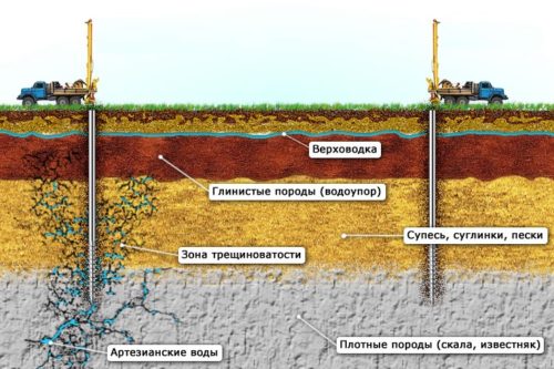
Aquifers - these soil layers which are between impermeable soils (generally stony or clay), and contain the water.
Floors of aquifer can run horizontally and with a slope, depending on the terrain. They have a roof - the upper covering rock, a certain thickness that characterizes the power of aquifer, and the sole - the underlying rock.
Depending on the depth of the occurrence and the main rock, three main aquifers are separated:
- ripper;
- sand horizon (sandy aquifer);
- limestone horizon (artesian water).
Verkhovodka
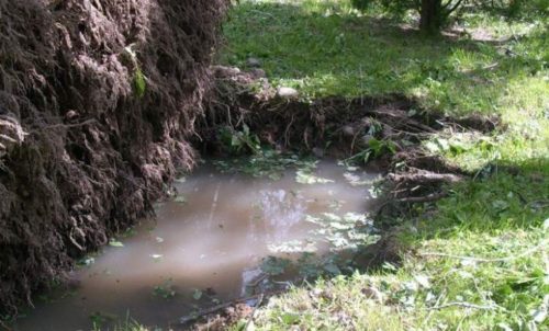
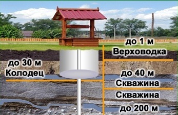
The ruption already in its name implies the closest foundation of the aquifer to the surface. The level of occurrence of such a layer varies depending on the seasonal precipitation and is between 1-1.5 m to 10 m and more (depends on the thickness of the roof). The roof of the rigor serves as a natural filter of the water replenishing this layer from the top layer of the soil (melting water, precipitation, etc.).
The ripper contains an unsuitable (in most cases) for drinking water, both in chemical and by bacteriological composition. Such water can be used for watering plants, construction and other technical purposes. The use of water from the supreme layers will require its multi-stage cleaning, which is quite expensive.
Sand horizon
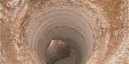
The so-called sandy horizon is the first aquifer containing fluid suitable for food use. Such layers have a rather constant level of occurrence, depending on the relief of 5-6 m to 30-40 m.
The purity of water in the sandy aquifer is provided by the excellent filtering during the passage of the upper rocks. However, the location of the liquid in the sandy soil leads to a large amount of sand in the water itself and requires a good multi-stage cleaning.
Limestone horizon
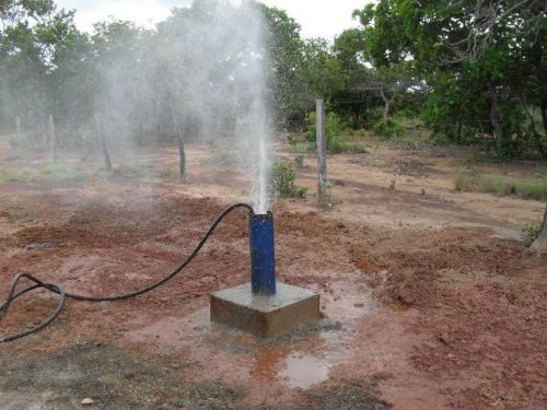
Where at a depth of 50 to 250 m (depending on the terrain), limestone lies, is the artesian waters. This aquifer contains the cleanest and high-quality water.
The excellent quality of artesian water is achieved due to the considerable depth of the occurrence, where the presence of various breed properties in its cleansing properties provide high-quality natural filtration. The wells for the depth of limestone are durable and can ensure uninterrupted supply of the site with water up to 50 years and more.
However, due to the fact that the artesian water is considered minerals, it will require a century sanctioned by the state. In addition, the cost of arrangement of the artesian well high enough.
How to independently find water on the plot. Choosing a hydraulic constructure
In order to proceed with the search for water on the site, it is necessary to determine what hydrotechnical structure is supposed to be used for water supply site.
Well
Well allows water to use water in the absence of power supply on the site and does not require significant investments of funds for its arrangement. It is possible to arrange a well with your own hands, which significantly reduces its cost.
However, the feasibility of building a well depends on the depth of the sandy horizon of pure water. If such a layer is at a depth of more than 15 meters, then dig a well will no longer be profitable. The usual depth of the well, to ensure water of the plot, ranges from 5 to 15 meters.
If water on the site is necessary only for technical purposes, then the well is exactly what will satisfy such a need for completely and without excess costs.
Well "On Sand"
If in the area of \u200b\u200bthe location of the site, the depth of pure water is more than 15 meters, then the preference is given to the well "on the sand".
Such a well is clogged in one working day (the well dug independently for the day is not real). Just like the well, the well "in the sand" involves the possibility of its independent arrangement. It is only worth making the bur for this ( How to make a bur for well drilling do it yourself). Such a hydraulic structure is more productive than the well and requires a less complex water purification system.
Well "On Limestone"
If you need the highest quality water for many years, the choice should be made in favor of artesian wells "on limestone". Such well round portion provides water and in many cases does not require a thorough cleaning, and has high productivity. In some areas, it is the only alternative.
How to find their own water on site. Ways to find water
folk ways
The popular ways to find water is generally best to determine where a well or deep well. Based on the fact that the wet soil from ground water evaporates moisture, can be determined aquifers place by the following features (alone or in combination):
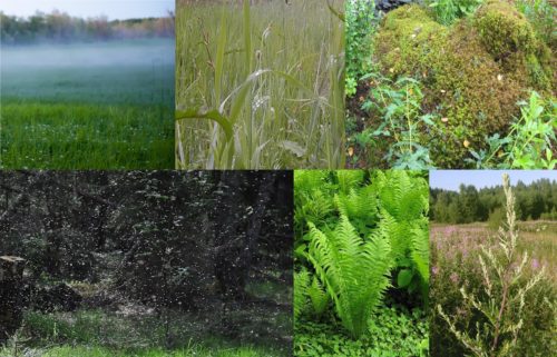
- The presence of fog in hot weather is early in the morning or late in the evening.
- Casting insects in the evening.
- Abundant morning dew.
- Moss covered place.
- The presence of abundant vegetation preferring the wet soils on the undeveloped area. Some plants can suggest an approximate depth of aquifer:
• Rogoz and swamp rod to 1 m;
• reed, poplar and birch fluffy from 1 to 3 m;
• Reed, Pyreshene, Spruce, Blackberry and Raspberries from 1 to 5 m;
• wormwood, fern, lingonberry, blueberries and clover meadow common from 3 to 7 m;
• licorice, alfalfa, pine common, cherry, oak black, juniper, hazel and cornflower from 2 to 10 m.
• Beech, Tolochang Drug, Cmin Sandy (immorter) and sage stitching from 5 m and more than 10 m.
Barometric measure
If the site is located near the reservoir, then it is possible to use a barometer to determine the aquifer under the well or the well "on the sand". For what:
- Measure the atmospheric pressure on the reservoir.
- Measure the atmospheric pressure in the selected location of the site.
- From the testimony obtained on the shore of the reservoir, deduct the testimony obtained on the site.
- Multiply the result obtained by 100.
- Taking into account the fact that the change by 1 mm Hg.st. Corresponds to a height difference in 1 m, we obtain the depth of the aquifer, corresponding to the water level in the reservoir in meters.

Example: if the measured atmospheric pressure on the shore of the reservoir differs from the obtained atmospheric pressure point of the point of the site by 0.5 mm RT. Art., then the aquifer lies at a depth of 5 meters.
Biolocation
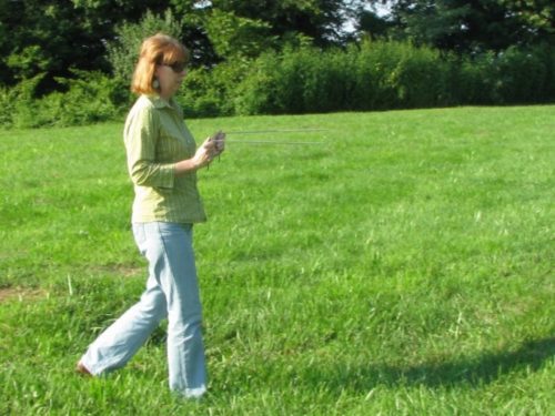
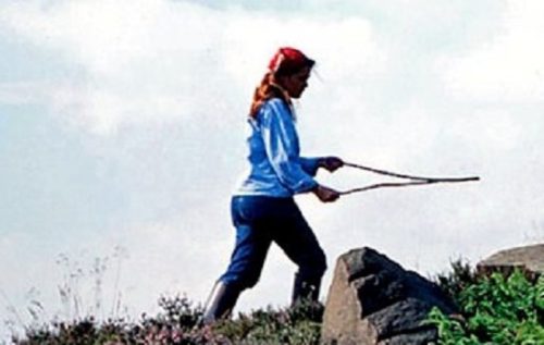
Use the biolocation method allows a simple device in the form of a frame. Frames are two coils bent at an angle of 90º aluminum wires. The total length of the wire is usually at least 30-40 cm, and the curved segment is 10 cm (the length of the segment is selected so that it is convenient to hold the frame in the palm fist). To achieve a more accurate result of the handle of the frames can be made from the tubes of ancient elderberry.
The probability of a positive result of the search for water with the help of a frame reaches 80%.
The procedure for searching for water with the following framework:
- The handles of the frames are not strongly clamped in the palms folded into the fist. One frame in the left hand, another in the right.
- The ends of the frames are divorced in opposite sides by 180 °.
- Holding the frames in the palms so that their ends can freely rotate, bypass the sites of the site that are located in the location and other signs are most suitable for building hydrotechnical structures.
- Where the frames come into motion, there is water. If the frames come close to the ends, then this is a sign of the presence of water in this place. If the framework has been separated from further movement, then in this place the aquifer ends.
- If the frames rotate the ends in one direction, then it is necessary to move in this direction (indicate the direction of the flow of water) until they become close to each other (before crossing).
- To localize the point of finding water, it is necessary to go to the specified (frame) place from different directions.
- If the frames remain fixed, this means that there are no water in these places or it lies so deeply that other ways to determine the aquifer layer are required.
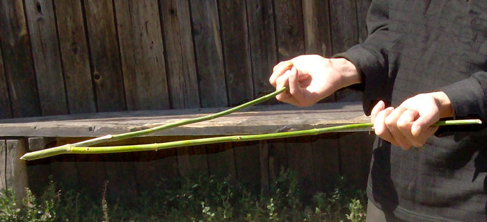
Also, the implementation of the method of biolocation is possible and with the help of horns from a tree. For this you need:
- Find a branch in the form of horns (two branches growing from one common branch, preferably the same thickness, not less than 1 cm).
- The cut part of the branch from which the two other forming horns grow, should be about 15-20 cm long.
- Clean the branch from the leaves and cut the thinnesses at the ends of the Hthins so that it remains about 40-50 cm to the total branch.
- Slide, if necessary, the rhotina branches at an angle of at least 150 ° and fix them in this position.
- Good to dry the horns.
- After drying, take the branch for the ends of the horns and hold it horizontally at the shoulder level.
- Coming over the area to monitor the movement of Rhotina.
- At the location of the water Rogatina will be clone to the surface of the soil.
- If the position of the Rhobhina does not change in any way, then it is necessary to choose another place or try other ways to search for water on the plot.
Trial drilling
The most reliable way to determine the aquifer is trial drilling. With the help of an independently manufactured bora (referred to above) or a conventional soda bora, you must drill a well to a depth of 2-3 meters. Then watch the focallement of these wells. If in the absence of atmospheric precipitations after 1-2 days they will not be filled with water at least a third, then you should find another place and drill well there. Filver the wells with water will confirm the correctness of the chosen, for the well or shallow well, the place.

Trial drilling to the very layer of water will require to deepen 10-15 meters. But the water thus obtained can be passed to the analysis of its quality, and the resulting effect will be the most efficient.
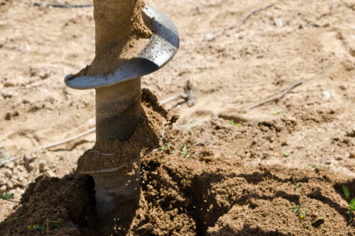
However, for the well "on limestone" will require deep drilling and it may not always be for independent implementation.
Other ways to search for water on their own on the plot
Also to determine the place where the aquifer can be located:
- View neighboring sites where the water source is already equipped and chat with its owners.
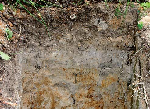
- Explore the terrain where the site is located. With the help of natural recesses (kotlovin, ravines, Loschkin and Vpadin), you can consider where the waterproof soil layers are located. Knowing the depth of location can be determined by approximately where the aquifer can be filled between them. However, it is necessary to remember that the layers of elevations may differ from the rest of the relief.
- Watch if there is an opportunity for animal behavior. In hot weather, animals are looking for cool and wet areas of the terrain.

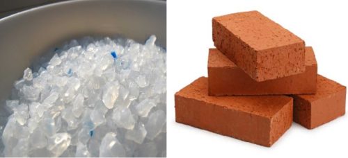
- Use silica gel.Well dried silica gel balls need to be filled into uncovered with a clay pot (1-2 l). Then measure and remember the weight of the pot with silica gel. Keep the pot into a dense tissue and bury in the selected place to a depth of 0.5 m (you can use several pots at once in different places). After a day, get the pot and winding it to measure weight. If the pot with silica gel sick, then he absorbed moisture, and this suggests that in this place there is an aquifer. The hard one became a pot with silica gel, the closer the water to the surface of the soil. So, using silica gel in different places, it is possible to quite accurately determine the place of the future well.
- Instead of silica gel, use a brick (several bricks) from red clay.
